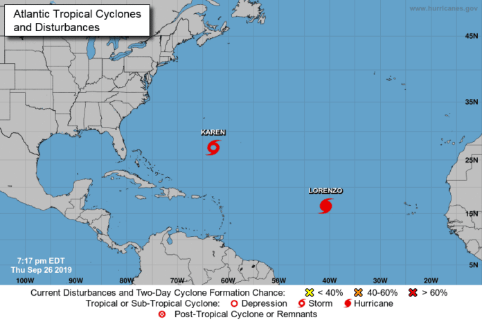
There are two tropical systems that we are watching in the Atlantic but both are expected to turn to the north in the coming days and not impact the United States coastline. We have Lorenzo in the Far Eastern Atlantic and likely to become a major hurricane, but once again we think it will curve to the north well before threatening the U.S. Stay aware in the coming weeks because this is a busy time in the tropics. On the local scene in Hernando County, we are looking sunny through Sunday with highs around 92 and lows near 69. The chance of showers will begin to increase early next week with chances at about 30%. After October 3rd it looks like our rain chances will increase to around 50% each day and high temperatures will cool down into the mid-80s.
Did you know that heat lightning is actually lightning from a thunderstorm somewhere? Back before radar was invented, folks would be sitting out in the evening on a hot night and they would see lightning flashing in the sky and they would think ‘well there’s no clouds so I guess it is heat lightning.’ When you see this, there is a thunderstorm somewhere. Lightning can be seen from a storm 100 miles away on a clear night. The old wives’ tale that a hot, humid night can generate lightning without a thunderstorm is exactly that–a meteorological myth. Heat lightning is just normal lightning from a thunderstorm too far away for the sounds of thunder to be transmitted. Our evening sky continues to feature Jupiter to the South- Southwest. Autumn has arrived and the Sun is getting lower in the sky. Sunrise on Friday will be 7:20 pm with sunset at 7:22 am. If you have a weather question or need weather data, email me at [email protected]

