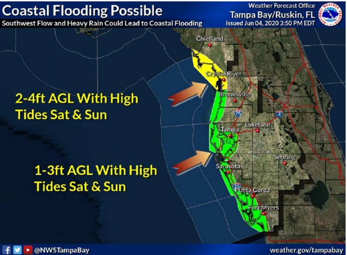
As Tropical Storm Cristobal drifts slowly northward through the Gulf of Mexico at the end of the week, a southerly wind flow over the Florida peninsula will create the potential for coastal flooding and a prolonged wet pattern through at least Monday. Areas from Hernando Beach northward could see water levels rise 2 to 4 feet above ground level. Combined with heavy rains at high tide, this may lead to slow drainage and coastal road flooding. High rain chances are expected each day as well across the entire area, with showers and isolated thunderstorms possible at any time.
IMPACTS
• Coastal flooding of 2 to 4 feet above ground level possible from Hernando Beach north to the Suwannee River during times of high tide Saturday night into Sunday.
o Note: Coastal flooding/storm surge values may be higher or lower depending on the future track of Tropical Storm Cristobal.
• Locally heavy rains and flooding of low lying and poor drainage areas.
·Gusty winds, frequent lightning, and isolated tornadoes or waterspouts possible.
·Marine conditions will also deteriorate over the weekend.
RECOMMENDED ACTIONS
• Register for automated severe weather notifications at http://www.AlertHernando.org
• Take this opportunity to refresh your emergency supply kit. For more information, visit http://www.HernandoCounty.us/EM
• Residents are encouraged to monitor local media outlets or the National Weather Service at https://www.weather.gov/tbw/ for current weather information
• Test your weather radio today and change the battery if needed

